
Land Quality Geochemical Survey Project
In 1999, China began organizing and implementing the "Multi-Objective Geochemical Survey Plan" (National Land Quality Geochemical Survey Project), covering 1.9 million square kilometers of arable land. A total of 54 indicators were analyzed, providing strong support for land management and utilization. Under the leadership of the Ministry of Land and Resources and with the support of the Ministry of Finance, the China Geological Survey, in coordination with provincial governments and their land resources departments, organized and coordinated 77 national units and over 100,000 personnel. Following unified technical standards and methods, they meticulously carried out the national 1:250,000 scale land geochemical survey. The "China Arable Land Geochemical Survey Report (2015)" was subsequently published.
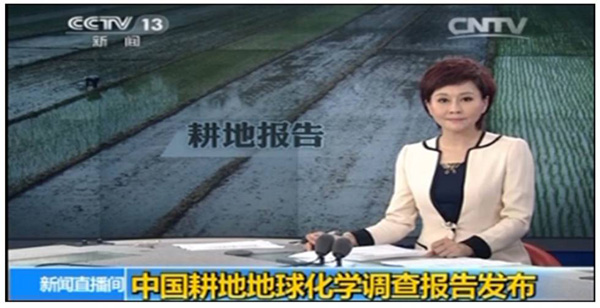
CCTV Broadcasts the "China Arable Land Geochemical Survey Report (2015)"
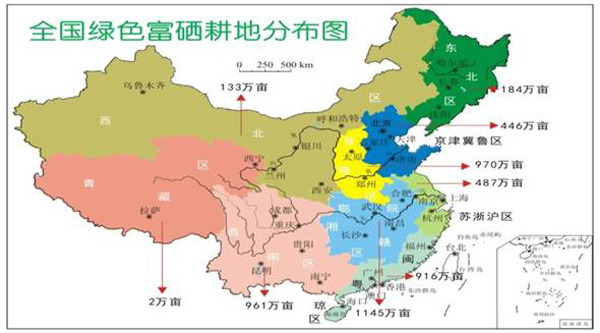
Distribution Map of Green, Selenium-Rich Arable Land by Land Use Area
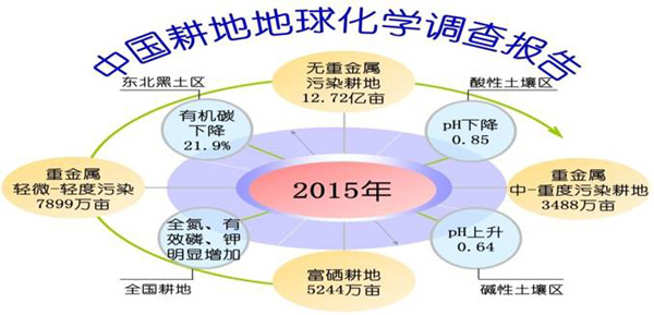
Geochemical Status of China’s Arable Land — A Data Perspective